All you need to know about drone surveying.
Drones are powerful tools in the mapping and surveying industry. They can effectively perform 3D mapping, land surveying, photogrammetry and topographic surveying while flying above the ground. Whether you’re looking to add another tool to your services or learn more about the world of drones, here’s everything you need to know about drone surveying.
What Is A Drone Survey?
A drone survey, also known as drone mapping or aerial surveying, refers to the use of unmanned aerial vehicles (UAVs), commonly known as drones, to collect aerial data and create detailed maps, 3D models, or other visual representations of the land, buildings, or objects below. These surveys are widely used in various industries, including agriculture, construction, mining, environmental monitoring, and land surveying.
How Does A Drone Survey Work?
Is a process in which drones (unmanned aerial vehicles) equipped with various sensors and cameras are used to collect data and imagery for mapping, land surveying, construction, or other applications. Here’s a basic overview of how a drone survey works:
- Preparation and Planning:
- Define the survey objectives: Determine what specific data or imagery you need to collect, whether it’s for topographical mapping, construction progress monitoring, land surveying, or any other purpose.
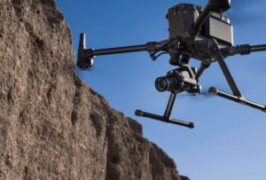
- Select the appropriate drone and sensors: Choose a drone model and sensors (e.g., RGB cameras, Lidar, thermal cameras) that suit the survey requirements.
- Plan the flight: Decide the flight path, altitude, and overlap of images. This planning is often done using specialized software.
- Data Collection:
- Launch the drone: The drone is flown to the survey area following the predefined flight path.
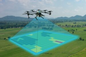
- Data capture: While in flight, the drone captures images or other data as it passes over the designated area. The sensors record information about the terrain, objects, or structures below.
- Data Processing:
- Data retrieval: After the drone survey is complete, the collected data is downloaded from the drone’s memory or storage device.
- Data processing: Specialized software is used to process the collected data. This may include stitching together images, creating 3D models, or generating topographical maps.
- Data Analysis:
- Interpretation: Surveyors or analysts examine the processed data to extract the required information. This can involve identifying changes in construction progress, measuring distances, or assessing land features.
- Reporting and Visualization:
- Report generation: The results of the survey are typically compiled into reports or visual representations, such as maps, charts, or 3D models.
- Data presentation: The data is presented to the relevant stakeholders, whether it’s for land survey clients, construction project managers, or other decision-makers.
- Decision-Making and Action:
- Based on the insights gained from the drone survey, decisions can be made and actions can be taken. For example, construction projects can adjust their plans, land boundaries can be defined, or progress can be monitored.
Drone surveys offer several advantages, including cost-efficiency, rapid data collection, and the ability to access remote or challenging areas. However, it’s essential to comply with regulations related to drone operation and ensure the accuracy and reliability of the data collected for various applications.
Among the various applications of drones in commercial settings, mapping and surveying stand out as a seamless fit. Drones eliminate the need for surveyors to invest days or even weeks manually traversing the survey area and taking measurements. Beyond simplifying surveying tasks, drones offer the advantage of generating highly precise data and models.
Nevertheless, conducting a drone survey requires more than just acquiring any off-the-shelf commercial drone. Not all drones are equipped for this specialized task, so here is a brief rundown of some of the top drones recommended for mapping and surveying purposes.
Do I Need a Drone Survey?
You may be wondering if a drone is better than traditional methods. There are many ways that they are more useful. These drones can acquire data from viewpoints that are inaccessible to humans, especially in areas with difficult terrain conditions. People do not need to measure points from physically dangerous places. However, traditional methods require advance planning before arrival. When a drone flies over an area, it can capture the same amount of data in less time. With drone surveying, a surveyor can collect data more safely and quickly than traditional methods. If you’re looking for a more efficient way to survey these areas, it may be time to consider a drone survey.
How Accurate Is a Drone Survey?
The precision of drone surveys hinges on a multitude of factors, encompassing the drone’s model, the quality of its camera, flight altitude, ground coverage, and the specific drone mapping software employed. High-end commercial survey drones can attain an impressive level of data accuracy, typically within the range of 0.5 to 2 centimeters, whereas other drones might only achieve an accuracy of about 5 meters. This makes them an incredibly accurate and efficient substitute for traditional surveying methods.
How Much Does a Survey Drone Cost?
I’ve frequently wondered, “What’s the typical price for a drone land survey?” The answer is multifaceted. Costs can span from around $75 to $150 per hour, and in certain instances, they might be based on the size of the land, with fees ranging from $50 to $500 per acre. Nevertheless, these rates can fluctuate significantly due to the unique attributes of your land and any additional expenses tied to your specific requirements.
Drones have revolutionized land surveys, making them more accessible, cost-effective, and likely even more precise. Compared to traditional surveys, it’s simpler to redo a drone survey if any errors occur.
I’ve covered how to initiate a drone survey, the diverse outcomes you can expect, the steps to conduct one, and even offered drone recommendations. While drone surveying isn’t exceptionally inexpensive, a career in this field remains viable, as numerous industries continue to require such services.